
A sad day has set for JAM, as we mark the last official day of excavations for the season (we’re considering the Young Archaeologists Club visit tomorrow more a post-credit scene). As we prepare to back fill, it’s time to look at all the progress we’ve made in the last week.
But first, that backfilling thing we just mentioned? Yeah we’re gonna need some help with that so if you would like to come along for a day and help as hoick soil back into our trench, please sign up on Plinth or click the link here!
Back to the updates.
A lot of our time has been dedicated to recording all of our features and test pits. We do this in a number of ways; the most important being hand drawings and context sheets, as well as GPS and some in the field photogrammetry with Dake.
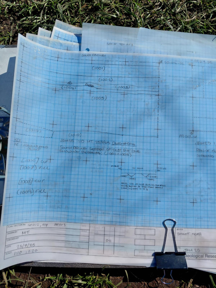
Image: Michael and Lillys’ sections drawings and plan of Test Pit 1.
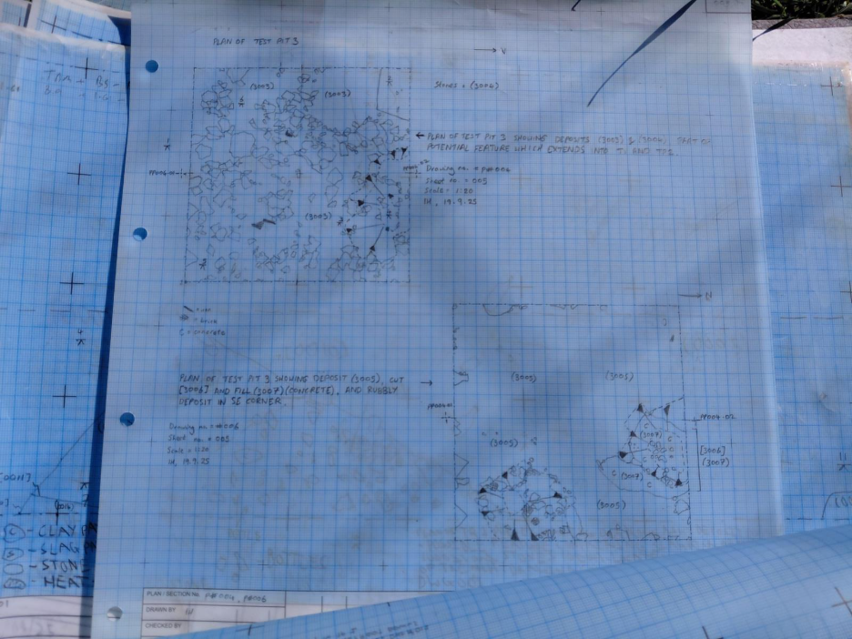
Image: Isabels’ plan drawings of Test Pit 3.
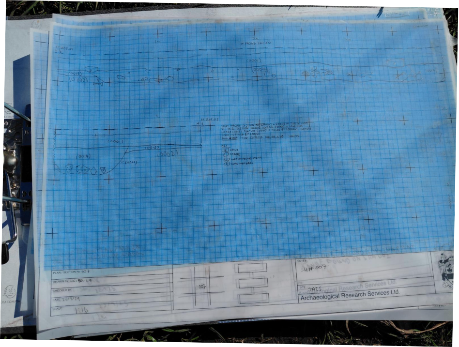
Image: Haydns’ section drawing of our strange stoney feature in Trench 1.
There are two types of archaeological drawings done in the field; sections and plans. A plan is a drawing of the trench, test pit or archaeological feature which is drawn from a birds-eye view. A section is a drawing of a vertical surface, like the edge of the trench for example, which records the different layers of soil, any potential human activity, and how these have built up over time, something also known as the stratigraphy. In the section drawing above we can see the cut of out strange stoney feature in Trench 1 and its relationship to the other deposits above and below it.
We also record that stratigraphy in something called a Harris Matrix. This is a way to simply show the stratigraphy of a site by representing each recorded feature or deposit as a number in a chronological sequence, which can be read top to bottom or bottom to top depending on who you ask. Below is a Matrix which records the relationships of three pits and a barrage Balloon tethering point found Test Pit 3.
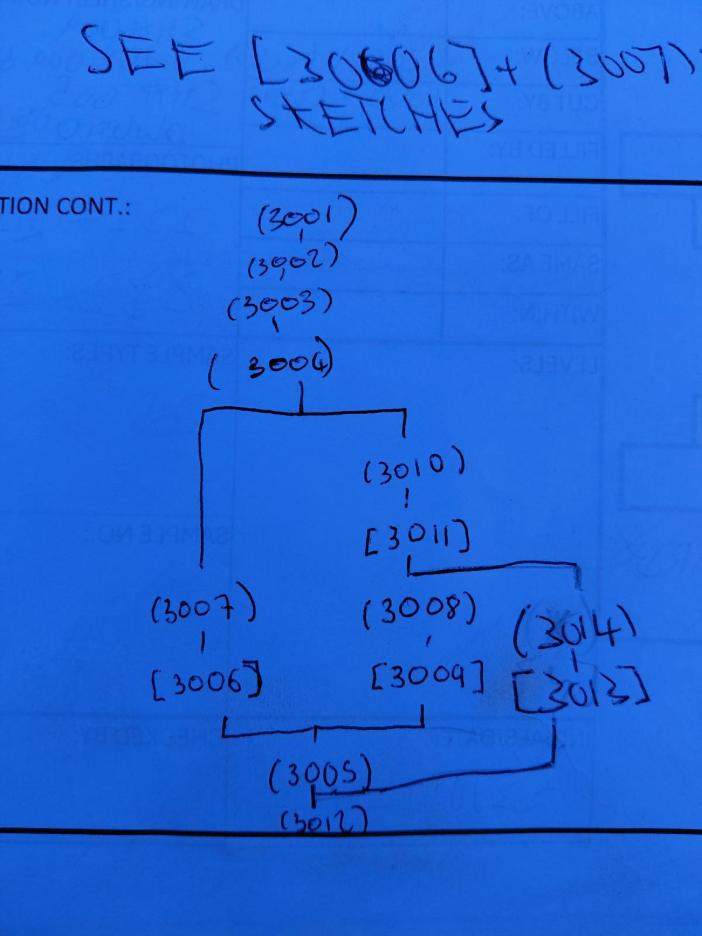
Image: Lilly and Haydns’ matrix of Test Pit 3.
From this matrix an archaeologist can see that we have basal layer (3012) which is cut by a pit [3013] which contains fill (3014), it was then covered by deposit (3005), into which were then dug two features, probably at about the same time, but which don’t otherwise interact with each other; cut [3006] with fill (3007), and cut [3009] with fill (3008), but cut [3009] not only disturbed deposits (3005) and (3012), it also disturbed feature [3013], and both were then disturbed again by cut [3011] which contains fill (3010). They were then covered by deposits (3004), (3003), (3002) and (3001). Easy.
The reality of all of those numbers looks like the series of pits, one on top of each other, we can see below.
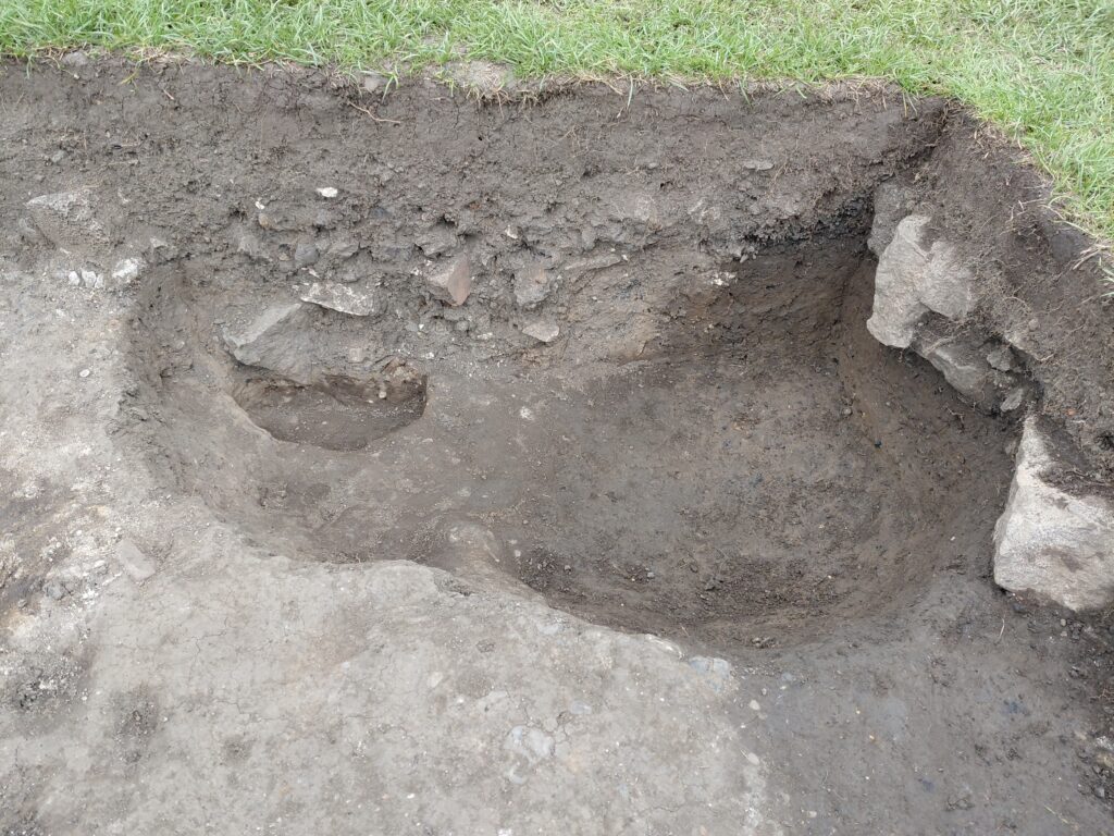
Image: The PitPitPit (or Pit²) in Test Pit 3.
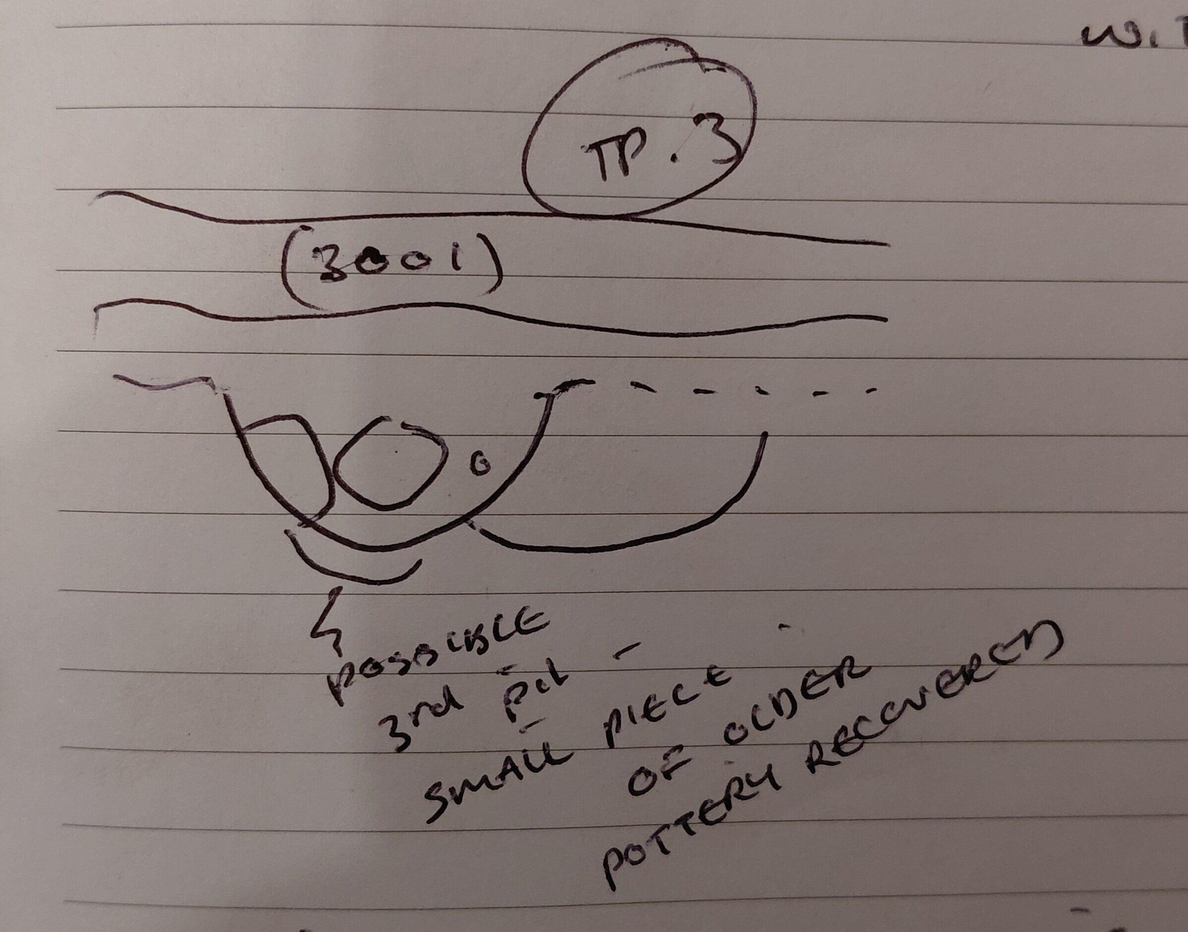
Image: Pit² as recorded in the site diary.
We’ve also had a cornucopia of weird and wonderful finds this week which reveal more and more about the people who lived in Jarrow and enjoyed Charlies’ Park through the centuries.
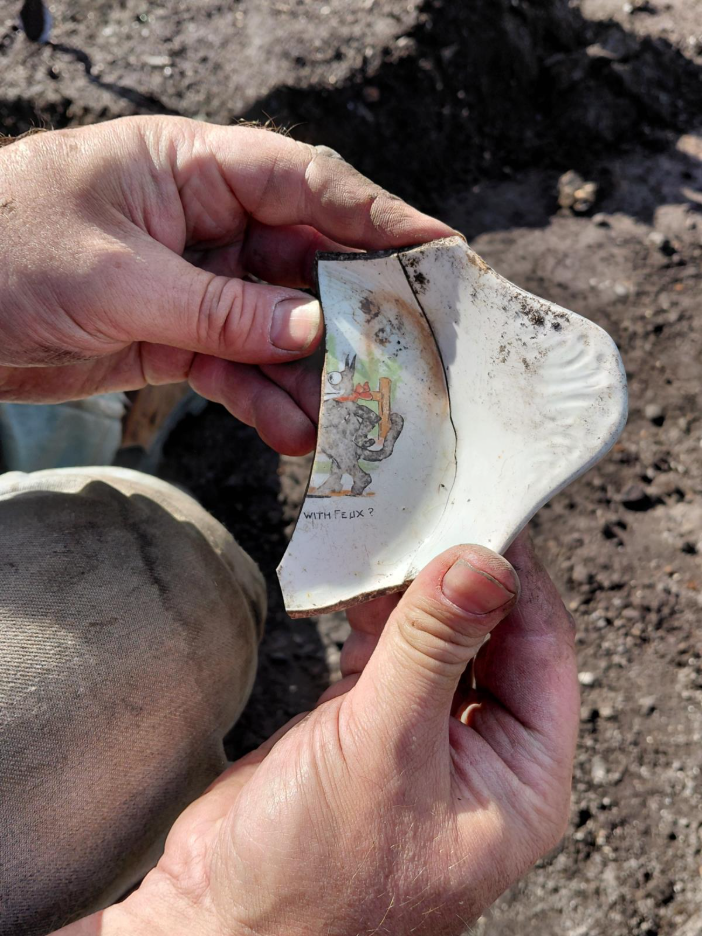
Image: A childs’ plate featuring Felix the Cat (c.1920s).
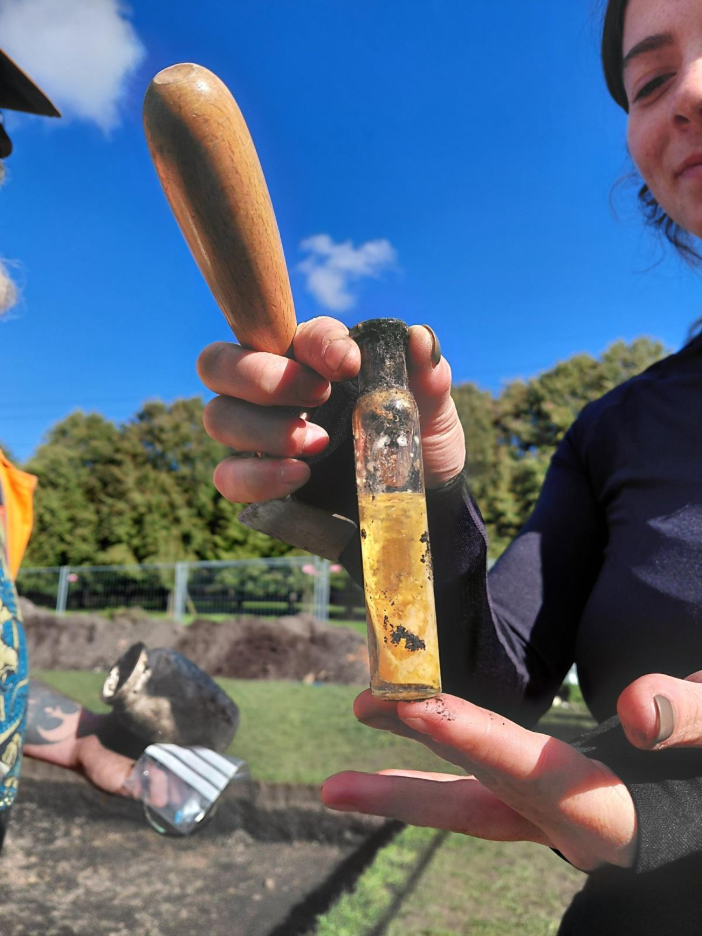
Image: A medicine bottle filled with mystery goo.
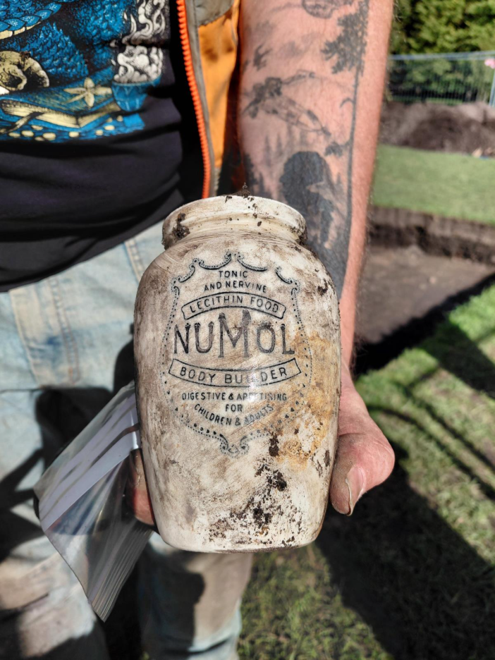
Image: Ye Olde Timey Protein Powder.
It wouldn’t be archaeology if we didn’t make an incredibly inconvenient interesting last minute discovery. In our case, a mysterious trench running East-West through Trench 1.
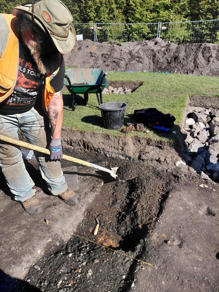
Image: Excavating our mystery feature.
The mystery feature was uncovered late on Thursday while the team were cleaning back in order to find the edges of an older version of the path that once ran from Church Bank to the old Jarrow Village and, unable to leave a single stone unturned, we got to work excavating it today to try and figure out what on Earth is going on. We’re unsure if the feature was a drainage ditch for the path, or perhaps a service trench for old gas lit streetlights. Regardless, when we got to work we discovered that it was full to the brim with old cans, pots, pans, iron kettles, stones and one very distressing clown shaped eggcup. On top of all of that we think we might have found the terrifyingly huge remains of our very own monster: The Jarrow Wyrm!
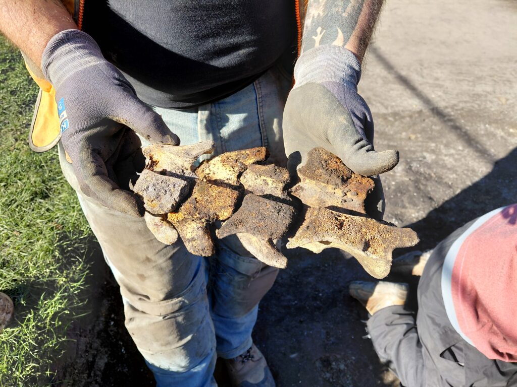
Image: Butchered vertebrae recovered from the mysterious feature in Trench 1.
Or maybe… these are the remains of a large cow or even a horse which show clear signs of butchery; these vertebral bones have been sliced in half and for some reason have found themselves deposited in the park, but a terrifying monster sounds far more romantic in our opinion.
And that is the final round of updates on this year’s excavation. We’ll be posting more updates everyweek as we move on to post-ex and research.
It’s been a busy few days on site, as we welcomed the V.A.A.N.E on Monday for their final day, as well as learners from the Route2Work college and Boldon School with Escape Intervention, volunteers from The National Trust, Gibside, and Groundworks very own Green Gym. The joy and enthusiasm for our shared history, as well as the archaeological process itself has been contagious, and the JAMFam are so grateful for all of the hard work everyone has put in.
Not to mention our dedicated Jarrow Hall and Public Volunteers, and our wonderful project Lead Volunteers, who’ve all pushed the dig forward, giving their own time to help make the Jarrow Archaeological Mission the success that it is. We also can’t forget our colleagues from Archaeological Research Services whose support and expertise have been invaluable.
That all being said, don’t think site closing means anyone is off the hook! We have plenty of opportunities coming up to assist with post-excavation finds processing, archiving, and even research and reporting. I promise that the biscuit bucket will be there as well.